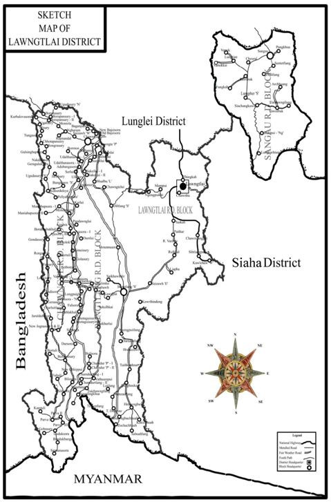
Lawngtlai District is situated in the southernmost part of the state of Mizoram. It was declared district on 18th September, 1998. The district is cut-off by Lunglei District and Siaha District into two parts. The eastern part is located in the eastern side of Chhimtuipui River, the biggest river in the state and it comprises Sangau Sub-Division. The western part comprises Lawngtlai Sub-Division (Sadar) and Chawngte Sub Division.The civil administration is taken up by Deputy Commissioner, assisted by ADC, 3 SDOs and 3 SDCs. The administrative sub-division of the district consists of Sangau, Chawngte and Lawngtlai (Sadar) Sub-Divisions. There are four rural development blocks to take up development initiatives at the grass root level for rural people.
There are 3 Assembly Constituencies namely – 36-Tuichawng AC, 37-Lawngtlai West AC and 38-Lawngtlai East AC. The district houses two Autonomous Councils, namely Lai Autonomous District Council and Chakma Autonomous District Council. Lawngtlai is the headquarter of Lai Autonomous District Council whereas Chawngte is the headquarter of Chakma Autonomous District Council.
Lawngtlai District is bounded in the north by Lunglei District, in the East by Myanmar, in the West by Bangladesh and in the South East by Siaha District. It has an area of 2,557 sq. kms. It is the fourth largest district by size. The area of the district falls between 21.58o-22.60o N Latitude and 92.20o-93.00o E Longitude. There are 161 inhabited villages and only one notified town within the District.The only town, which is Lawngtlai is the district headquarter with a population of 20,830, making it the 7th largest urban area by population in Mizoram. Lawngtlai is situated at an altitude of 847 metres above mean sea level.
POLITICAL MAP